
![]() Much of the Southern California coast is a long beach with tall cliffs. The cliffs, topped with pricey real estate, are erodible. According to Ed Curtis, we have two options. “Option one; stabilize the bluff and eventually lose the beach. Option two; provide beach nourishment by planting dunes. Beach nourishment is not sustainable. All the rivers we’ve dammed have stopped natural sediment, which would have naturally distributed sand. There is no natural replenishment.”
Much of the Southern California coast is a long beach with tall cliffs. The cliffs, topped with pricey real estate, are erodible. According to Ed Curtis, we have two options. “Option one; stabilize the bluff and eventually lose the beach. Option two; provide beach nourishment by planting dunes. Beach nourishment is not sustainable. All the rivers we’ve dammed have stopped natural sediment, which would have naturally distributed sand. There is no natural replenishment.”
Ed Curtis is an upbeat guy with a ready smile, a bum knee, and a grim prognosis for tomorrow. He was also my college roommate, fellow civil engineering student, and best man at my wedding. For the past ten years or so, Ed’s been an engineer in FEMA’s Mitigation Division, where his focus is how the water meets land, during storms and rising seas.
 FEMA is responsible for creating and maintaining the maps that establish the 100-year flood zone, an all-important line that determines flood insurance requirements and affects the development of millions of acres in the United States. Everyone wants property on the water; no one wants it designated in the 100-year flood zone. From an engineering perspective, its a big task but not all that difficult. From a political perspective, it’s a nightmare. “FEMA’s regulations state that manmade barriers are not factored into flood control. But if someone’s built a levee around a retention pond, and they raise a ruckus, there will be debate.”
 The Mitigation Division’s charge is to make communities more resilient, so fewer natural disasters occur, and when they do, community response saves lives. Ed attends many CERC meetings – Community Engagement and Risk Communication. His task is to inspire community groups and elected officials to take mitigation action: rezoning, erecting hard barriers, and creating evacuation plans. “It’s difficult for us, as engineers, to convince people to make major changes.” That’s why FEMA has contracted with Oglesby Communications to craft a story around the engineering facts that will help motivate communities to action.
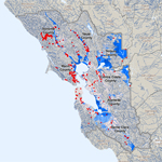
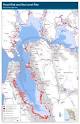 Congress requires that FEMA assess their maps every five years to determine whether the represent current conditions. They’ve also funded map updates to create digital maps. But the land and the sea continue to change faster than FEMA can track. Ed’s current focus is to digitally update all of California’s coastal maps. The plan requires FEMA to make new maps, but has no provision for assessing how sea level rise will affect them. FEMA created a pilot project to apply their 2050 / 2100 sea level model to San Francisco’s open coast. Unfortunately, the model indicated that sea level rise would actually amplify the impact of a 100-year storm. Twelve inches of sea level rise resulted in storm waves 36” to 54” higher than what the city experiences currently under those conditions.
 Ed believes the sea is rising, but not everyone in Congress is on board with that science. FEMA’s coastal mapping effort is limited to documenting existing conditions; it does not address how conditions will shift as the climate changes. There’s is a glimmer that Congress is catching up. “The 2012 Flood Insurance Bill requires some extrapolative work to map future conditions.” For Congress, that represents a giant step.
Regardless of how we map and project, Ed doesn’t see long-term engineering solutions as viable options along California’s long coast. “Mitigation, from a climate change perspective, has to be adaptation.”
How will we live tomorrow?
 “I’m not optimistic. Poor little Morgan (Ed’s granddaughter); I don’t think the planet can support the affluence Americans are used to. I think the damage is irreversible. The persistent drought has already changed some areas.
“The question is, how quickly can we respond when areas that we rely on for agriculture are no longer viable? Right now we don’t have the political will to make long-term commitments. I think the time is now, or it’s already passed. We will pay the consequences.”
